G&G advances critical for shale definition and efficient development
Exploitation of unconventional resources, such as shale, calls for new exploration tools to address unique challenges.
BILL PIKE, Editorial Advisory Board Chairman
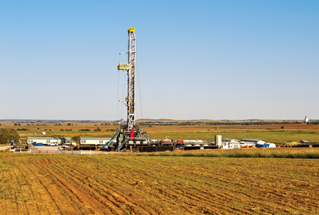
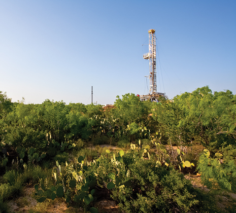
SHALE CHARACTERISTICS Shale formations consist of fine-grained laminated rocks that are formed of compacted silt and clay. They make up some 60% of the earth’s sedimentary crust and are the primary source rock for most of the conventional hydrocarbon deposits in the world. Depending on their maturity, they may be naturally fractured and may also be easily fractured mechanically. As with all hydrocarbon reservoirs, shales require pressure and temperature to develop mature oil and gas. Younger shales possess kerogen, an immature hydrocarbon. During burial and maturation, kerogen passes through ranges of temperatures and pressures. The first of these ranges is the oil window which produces liquid petroleum. This process is referred to as catagenesis. A second window, developed under additional burial, results in the generation of dry gas. This process is known as metagenesis.1 In addition to serving as source rock, shale is also reservoir rock, characterized by adequate porosity but limited, to very limited, permeability. Although many shales are naturally fractured, most are incapable of meaningful production without hydraulic fracturing to increase flow potential. Understanding the characteristics of a given shale—mineralogy, brittleness, porosity, permeability, stresses, natural fracture systems and more—is crucial for successful fracturing and optimum production. However, despite their worldwide abundance, most shale reservoirs cannot be developed as hydrocarbon plays, due to the lack of adequate organic material for the creation of oil and gas. Organic-rich shale formations form under special conditions—high levels of organic matter and low levels of oxygen—differentiating them from other shale deposits. SEISMIC CHALLENGES For some time, many in the seismic community have believed that a new era in land seismic is at hand. They believe that growing energy demand, particularly in shales, will spur greater efforts in exploration and development into regions of the world, where shale development potential is large, Fig. 1. But achieving that new era requires solving a number of problems inherent in land seismic acquisition. The largest of these problems is overcoming near-surface inhomogeneities that distort seismic at shallow levels.2 Additional challenges include high density, extensive acquisition geometries and fractured reservoir characterization.3
Near-surface complexities. It has been said that the top 10 problems faced in land seismic acquisition are all associated with near-surface inhomogeneities. Geological effects that generate unwanted noise and data processing hurdles include topography, sand dunes, dry river beds, steeply-dipping layers, outcropping refractors, lateral velocity variations, velocity reversals, layered basalts, carbonate karst and anisotropy. These result in a variety of surface waves, scattered noise, scattered signasls and static/dynamic effects. Solutions to these problems are in development, including simultaneous source acquisition and wireless, seismic-driven ultra-high-channel systems. Advances in seismic processing technology, for processing the resulting huge data volumes, will be made possible by continual growth in computational capability. These advances will, for the first time, allow acquisition of true 3D seismic data.2 Further solutions to near-surface complexities are being developed in the SEG Advanced Modeling Program (SEAM). Realistic near-surface earth models, based on geological parameters and transformed to rock physics parameters, are under study and development by SEAM. The efficiency of full elastic simulation codes continues to improve, driven in part by the activities of SEAM Phase I. Near-surface simulations can now be acquired for evaluation of acquisition, processing and imaging schemes. This will not only result in better imaging of the subsurface, but will allow the near surface to be addressed as an imaging problem with better description of velocities and suppression of surface related noise.3 In addition to near-surface complexities, SEAM-facilitated industry discussions during 2009 and 2010 have identified two further core challenges that Phase II should focus on:
High-density acquisition. The earth is three-dimensional. Industry’s experience has consistently been that subsurface images improve with every acquisition and processing advance that moves toward “true 3D.” Marine wide-azimuth acquisition is a good case in point. However, land channel counts have always been limited by what is technically, economically and operationally feasible. The trend is toward ever-increasing channel counts enabled by increased use of wireless transmission. However, the questions continue as to how to best deploy those channels and the seismic sources. Such questions include: is dense inline sampling with sparse cross-line spacing better than a grid of shots and receivers? Dense inline sampling acquires un-aliased data along each line, but it is sparse from line to line. Grids acquire aliased data, but capture more of the wave field. Acquisition designs have progressed from orthogonal to brick to zig-zag to slash patterns (and back!). Which is better, and when? Receiver and source arrays are used to suppress noise, also suppress signal bandwidth. Intra-group statics pose even more severe problems for shear wave recording. The future appears to be un-aliased 3D point-receiver recording, will the data quality gains justify the operational effort? Simulated data sets acquired over high-resolution earth models offer a cost-effective approach to evaluate the technical benefits of high-density recording. The wavefield can be fully sampled in three dimensions. Operationally, achievable acquisition geometries can be extracted and compared through decimations of the simulated datasets. The effect of irregular geometry on the interpretation of various seismic attributes can be investigated, Fig. 2. Receiver-array effects can be simulated by blending adjacent bins.
Fractured reservoirs. Unconventional reservoirs, including both tight sands and shale, are of increasing importance. Advances in drilling and completion technology are driving an industry renaissance, with increasing use of seismic data for horizontal well trajectory planning and “sweet spot” identification. Sweet spots include lithologic effects, such as carbonate and organic content; as well as an understanding of in situ stresses and existing fractures. The economic objective of full azimuth p-wave and s-wave surveys is often to identify regions with lithology, structure and stress patterns most conducive to hydraulic stimulation. Imaging is complicated by vertical transverse isotropy (VTI) in both the overburden and the target interval. Horizontal transverse isotropy (HTI) in the target interval provides the means to identify fracture density and differential horizontal stresses. What are the relative benefits of multi-component data, as opposed to azimuthal anisotropy analysis of P-wave data only? How can the useable bandwidth be increased? Is surface seismic an occasional curiosity or an essential component of a fractured reservoir exploration and development program? Rock physics models for fractured reservoirs are still poorly understood, but much academic and industry research is underway. One example of that research is a Research Partnership to Secure Energy for America (RPSEA)/U.S. Department of Energy funded project to develop and demonstrate a technology that uses vertical-force seismic sources, combined with a vertical seismic profile (VSP) to provide a seismic "log" of natural fracture orientation and density in unconventional reservoirs. The project is being undertaken by the University of Texas, Bureau of Economic Geology, in Austin, Texas, and the GEDCO–integrated geophysical survey design software and services company that is part of Schlumberger’s WesternGeco business unit.4 Project background. A common feature of shale gas units and tight sandstones is that most of these unconventional reservoirs have embedded fracture systems that need to be understood, in order to position exploitation wells, Fig. 3. A remote seismic technology that can “visualize” the internal architecture of unconventional reservoirs, and predict fracture orientation and density, will be invaluable for characterizing tight sandstones, shale-gas units and all unconventional resource plays. Current technology has demonstrated that shear (S) waves are more responsive to fractures than compressional (P) waves.
Based on this knowledge, operators across unconventional reservoir plays need an effective, low-cost way to illuminate reservoir systems with surface-generated S waves. This project will develop a technology whereby S waves can be produced with simple, low-cost, and widely available seismic sources that apply a vertical force to the Earth. The technology utilizes S modes created directly at the point where a vertical force is applied to the Earth’s surface, which is in contrast to current practices of using sources that apply a horizontal force to the Earth, or converted S modes produced at subsurface interfaces, by downgoing P wavefields. In addition, researchers on this project will present field procedures and data-processing strategies, whereby S modes produced by vertical-force sources can provide fracture-sensitive attributes. These procedures remove current practice limitations, because vertical-force sources (vertical vibrators, vertical impacts, shothole explosives) are lower-cost, more abundant than horizontal-force sources, and usable over a wider range of terrains. This approach refutes the common assumption that the only way to create a downgoing vertical shear (SV) mode with a vertical-force source is to use a shallow interface, to produce a downgoing P-to-SV mode conversion. An important feature of the technology is that fracture properties can be estimated several tens of meters away from a receiver well, rather than the 1-m distance required for a dipole sonic log. The outputs of the project will be: 1) a demonstration of correct field procedures for acquiring orthogonal SV-wave vectors; and 2) software source code that performs data analyses to convert orthogonal SV-wave data into estimates of fracture orientation and fracture density. Potential impacts. The seismic technology developed in this study will allow improved mapping of fracture orientations and densities in unconventional reservoirs, thus addressing the objective of advanced visualization to enhance unconventional production. Technology will be developed, using VSP data acquired in shale-gas and tight-sandstone reservoirs, but it can be applied to any fractured reservoir. Providing operators with better knowledge of fracture density and crack orientation should result in increased oil production, Fig. 4.
Simplifying S-wave seismic source activity, by utilizing S modes created directly at the point where a vertical force is applied to the Earth’s surface, will result in less-costly data acquisition and fewer environmental issues caused by source deployment. An important impact is that vertical-force seismic sources can be utilized in a wide variety of terrains, where horizontal-force sources cannot be deployed. Accomplishments. The experimental methods implemented consisted of analyzing average P and S velocities in a walk-around (WAR) VSP, acquired over a Marcellus shale prospect. Seventy source stations were distributed around the VSP receiver well at azimuth increments of approximately 5°. Data were acquired by a vertical array of 16 receivers positioned across a depth interval of 5,820 ft to 6,570 ft. These receivers were approximately centered on the Marcellus shale. Simple, straight-raypath calculations of average velocity from each source station to each receiver station allow azimuth velocity behavior to be analyzed. Both P and S velocities vary with azimuth, with maximum velocities occurring in a north-northwest direction for both P waves and S waves. BEG tentatively assigned this high-velocity azimuth direction as the direction of maximum horizontal stress. This conjecture will be verified by local stress data. The data confirmed the following important principles of S-wave physics: 1) SH and SV shear modes propagate with different velocities; and 2) SH velocity is greater than SV velocity, when raypaths have a significant horizontal component, as they do for this WAR VSP source-receiver geometry. S waves are produced directly at source stations, where a vertical-force source applies its force vector to the Earth. The project has received two recently acquired VSP data sets that will be used to develop fracture delineation methodology. GEDCO, a geophysical company, provided the geophysical data processing software package to be used in the project. Software has been developed to analyze the two recently acquired seismic data sets. A literature review, to determine the relevant seismic data processing software needed to analyze the Vertical Seismic Profile (VSP) data sets, has been completed.
Two VSPs have been processed, and these datasets are being analyzed to determine fracture delineation, using SH and SV shear modes in shale gas reservoirs. The seismic technology developed in this study will improve mapping of fracture orientations and densities in unconventional reservoirs. The technology will be developed, using VSP data acquired in shale gas and tight-sandstone reservoirs, but can be applied to any fractured reservoir. Providing operators with better knowledge of fracture density and crack orientation should result in increased shale gas production, Fig. 5. CORING AND LOGGING ANALYSES Geochemical characterization. Specific geochemical properties are looked for, when assessing a shale formation for potential development. These include total organic carbon, gas volume and capacity, thermal maturity, permeability and mineralogy. These geochemical properties are normally derived from core data and correlated to log data.1 Total organic carbon refers to organic carbon content as a percentage of the whole. Most shales begin with higher, total organic carbon and, over time, total organic carbon content decreases. Rocks with organic content carbon values of 2% to 10% are considered adequate for development. Total organic carbon values above 10% generally indicate rocks that are too immature for development. Examination of cores using a combustion technique is the most accurate method to identify total organic carbon. However, because it is not feasible to acquire and analyze cores over long intervals, “data from geochemical and conventional logging suites are used to quantify the volume of kerogen in the rock and then compute total organic carbon values from these data. To validate the models used to measure total organic carbon, scientists calibrate petrophysical data to core-derived values.” Gas volume and capacity is a combination of adsorbed and free gas. Adsorbed gas adheres to the surface of the kerogen, while free gas is distributed in primary and secondary porosity. As free gases areproduced, and reservoir pressure lowered, adsorbed gas releases from kerogen and becomes free gas in a desorption process. Total combined, adsorbed and free gas, or gas in place (GIP), is measured from cores. Thermal maturity indicates the maturation process of kerogen under depositional time in pressure over time. Thermal maturity is measured by vitrinite reflectance (RO). RO values typically range from 0% to 3%. Amounts above 1.5% are assigned to dry gas-generating source rocks, usually a sign of for gas shales. RO ranges of 0.6% to 0.8% indicate oil, and ranges of 0.8% to 1.1% indicate wet gas. Permeability is a function of effective porosity, hydrocarbon saturation and mineralogy, and indicates the ability of a fluid flow through the rock. Permeability is measured in darcies, with low and exceptionally low permeability registering in milidarcies. Shale permeabilities may reach nanodarcy ranges. Permeability is generally measured by forcing fluids through cores while measuring volumes and rates. Permeability in the nanodarcy ranges generally precludes this type of measurement. Mineralogy describes the mixture of minerals on the rock. Shales can have very complex mineralogy, greatly affecting their potential as a source rock. Mineralogy is generally determined using logging, which is calibrated to core data. PETROPHYSICAL DATA Gamma ray, resistivity, porosity and acoustic log data are used for petrophysical analysis of shale, in addition to the neutron capture spectroscopy data.1 Gamma ray logs provide some of the first indications of organic-rich shales in formations. Because organic matter usually contains higher levels of naturally occurring radioactive materials, shales rich in organic matter generally display gamma ray counts in excess of 150g, API, allowing petrophysicists to identify them. Resistivity measurements in gas-bearing shales are usually higher than those in surrounding shales with little or no gas potential. Porosity measurements also can have distinct characteristics in gas-bearing shales. Generally, conventional shales exhibit a uniform separation between the density porosity and neutron porosity measurements. Organic-rich shales, however, exhibit more variability, higher density porosity and lower neutron porosity. Acoustic measurements provide mechanical property measurements for shales and are useful in predicting the long-term productivity of shale gas wells. Spectroscopy tools identify mineralogical characteristics, including fracture potential. Spectroscopy also provides information on characteristics of clay types, which allows engineers to further assess fracture characteristics and chemical sensitivities. These tools can also identify rocks that are ductile and will not fracture easily. Measurements from these tools, in various combinations, are generally combined into an integrated display that allows in-depth analysis of shale potential.
REFERENCES 1. Alexander, T., J. Baihly and C. Boyer, et. al., "Shale Gas Revolution," Oilfield Review, vol. 23, no. 3, pp. 44 – 46, Schlumberger, 2011. |

